Technical Tidbits From Spatial Analysis & Data Science. This nice blog highlights many technical aspects of web mapping: Leaflet, D3, R... lots of neat examples.
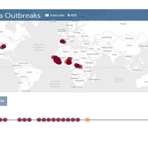
HealthMap, an automated electronic information system that monitors data from electronic media sources (e.g. social media, government websites, physician social networks) in order to visualize and foster an understanding of infectious disease outbreaks around the world.
Sean Hogan attended the 1st Statewide California Naturalist Conference, which took place at the Asilomar Conference Grounds in Pacific Grove CA this weekend (October 17th to 19th), and has provided us with this report. By all accounts the conference was a resounding success.
For the past several months IGIS has been working on a Geospatial Staff Development Plan (Plan) for UC-ANR in collaboration with Environmental Systems Research Institute (ESRI) - the industry leader in GIS technology.
New for 2015, the DigitalGlobe Foundation Award for the Application of High-Resolution Digital Satellite Imagery will make available one new collection of imagery in addition to the archive imagery previously available.