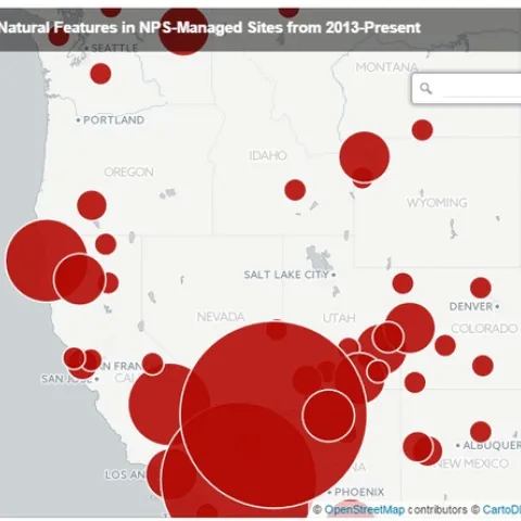
Here are the tag clouds from this year's GIS class: the why, how and what of our upcoming semester's projects. Word clouds from Wordle. The Why: what are the key problems class members want to focus on... The How: possible methods we will use... The What: some of the datasets that might be used...
Here in the Kelly Lab we talk a lot about effective ways to visualize data. How do we show the true weight and impact of those data we work with? How do we communicate uncertainty? I think this fellow Neil Halloran did a pretty great job with WWII.
Students, researchers, mappers, and big data enthusiasts took place in an exciting 2 day Google Earth Engine workshop this last week hosted by the GIF and the Google Earth Engine Team.