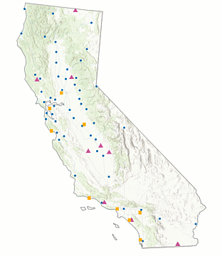
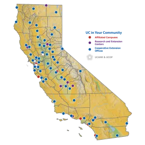
Have you ever needed a basic map of ANR's CE Offices, campuses, or RECs?
Do you sometimes need to show some county-level info on a simple map for a presentation, handout, or publication?
If either of these apply to you, you should sign-up for a special webinar from the Informatics and GIS group on Nov. 18, 2025 at 1pm on How to Make ANR Maps *without* GIS!
The webinar will introduce two new tools developed by the GIS nerds at IGIS that allow you to make simple, custom maps of the ANR network and California's 58 counties, without a single piece of GIS software!
The webinar will teach you how to:
- use a new "clipart pack" of stock ANR maps that look great in presentations and websites
- download a PowerPoint template that has map layers that you can mix, match, and format to make tailored maps of ANR's network and CA's counties.
More info and registration can be found here.
This webinar is being held as part of UC GIS Week 2025, a three-day virtual conference of GIS related topics across all the UC campuses. To see the entire program and register, click here.