Drone Image Processing with Drone2Map
Webinar: October 24, 2025, from 1:00 to 2:00 pm
Overview
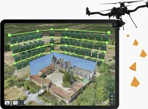
ESRI's drone image processing application Drone2Map shows promise to become one of the most widely used photogrammetric processing applications currently available. This webinar will introduce to principles of photogrammetric processing, the easy process of administering the Drone2Map app through an organizational ArcGIS Online account, and will demonstrate its basic workflows for image processing within the app. This includes:
- Resources for applying for free K-12 standard educational Drone2Map licenses
- ArcGIS Online license administration of ESRI's apps, including Drone2Map
- Standard and Advanced Drone2Map capabilities and limitations
- Exporting processed results to ArcGIS Pro
- Drone data structure
Audience
- UC Cooperative Extension
- UC students & faculty
Cost
This is a free webinar.
Registration
Click here to register. A Zoom link will be emailed to registered participants a couple of days before the webinar. The recording will be posted on the IGIS YouTube Channel and linked on this web page.
This course content is the result of a collaborative effort between the UC ANR IGIS Statewide Program and the UC ANR 4-H Program.